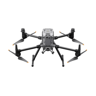
PROVISIONAL PLATFORM TO DISCUSSDJI specifications
EXPLORING DRONE DELIVERY
Could drones make a difference to your urgent deliveries? We’re working with businesses to understand real delivery needs and identify practical opportunities.
Starting with real journeys and a practical assessment.
BUILT AROUND THE WAY YOU WORK
Start with the parts, people and journeys behind your business. Then shape a practical system that could connect your depot with the teams who need it.
Review delivery examples, packaged weights and sizes, destinations and urgency. Identify where waiting for a part or travelling back to base affects the working day.
Identify a dispatch hub, suitable receiving areas and the people on site. Assess the routes and plan how trained staff would receive each delivery.
Plan how a part is requested, checked, loaded and dispatched, then handed over to your engineer. Include clear communication and a road-delivery fallback.
Use a focused trial to measure delivery times, handling effort, engineer travel avoided and cost. Refine the approach before deciding on a regular service.
YOUR WORKFLOW, CONNECTED
Request · check · prepare
Planned routes & receiving arrangements
Delivery results feed back into the system.
Illustrative workflow. Routes, sites and operating arrangements must be assessed before flight.
WHAT A SUITABLE SYSTEM COULD CHANGE
Explore whether getting parts to the engineer could reduce trips back to the depot and time away from the job.
Identify journeys where a direct delivery could shorten the wait for a missing tool or replacement component.
Use trial evidence to compare the system with current deliveries, then decide whether it makes operational and commercial sense.
The system is developed around your delivery data. Drone operations remain subject to feasibility, site suitability and the necessary approvals.
HOW IT WORKS
A clear plan and cost estimate first. Then, if you choose to proceed, the preparation and live testing needed to build a working service.
PLAN AND DECIDE
Talk through what needs to move, the delivery challenge and the outcome you want.
Provide example journeys, packaged weights and sizes, timings, frequency and current costs.
3AM develops a proposed delivery system, suitable routes and sites, and an estimated breakdown of trial and operating costs.
We present the study findings, proposed approach and cost estimate. Review the options together and decide whether to proceed.
Your decision. Continue with the next stage if the plan fits your business, or pause after the study.
IF YOU CHOOSE TO PROCEED
Arrange the required CAA operational authorisation, supported by a UK SORA risk assessment where applicable, alongside site permissions, operating procedures and team preparation.
Run approved trial deliveries and measure timings, reliability and cost. Review the results before deciding on a regular service.
If the results support it and approvals are in place, agree a service plan and introduce regular drone deliveries, with ongoing monitoring.
Approval requirements, timing and the final service scope depend on the proposed operation. CAA guidance
NEED SOMETHING MOVED BY ROAD?
Explore courier enquiries for single collections, multiple drop-offs and regular business journeys.
EXPLORE YOUR DELIVERY NETWORK
Map your pickup hub and possible destinations. Explore a provisional DJI platform and the questions a feasibility study would need to answer.
Straight-line illustration · 50 m either side of centre
YOUR INITIAL PLANNING VIEW
Add a hub and destinations to see the connections and a provisional platform. No aircraft, route or operation is approved by this tool.
Checking the illustrated footprint…
Census 2021 resident averages for neighbourhoods in England and Wales. These can hide dense pockets and daytime crowds. They are not the maximum exposure required by UK SORA.
Lines connect the hub directly to each destination centre. The shaded strip extends 50 metres either side of each centre line, with rounded ends. Delivery-area circles show the radius you selected. These are illustrative study footprints, not approved routes, operational volumes or calculated ground-risk buffers. Routes to other points inside a circle are not modelled.
The population figure is the highest Census 2021 LSOA neighbourhood average among boundaries intersecting the illustrated footprint. It is not a count of people in that footprint, a 100-metre population grid, a SORA Ground Risk Class or an approval prediction. Small populated pockets, workplaces, roads, gatherings and adjacent areas need further assessment. Airspace, obstacles, land permissions and site controls are not checked here.
Aircraft names are discussion candidates. Matrice payload ratings cover equipment and any cargo integration; they do not demonstrate a ready-to-use delivery system. Manufacturer maximum flight figures are not an operating radius.
A feasibility study comes first. Flights require an appropriate authorised operator, suitable equipment, site arrangements and all necessary permissions.
LET’S START WITH YOUR DELIVERY CHALLENGE
Tell George about a regular journey or an urgent delivery challenge. We’ll explore the fit before proposing any trial.
info@3amgroup.co.ukBased near Knebworth. Start with an email or an enquiry.